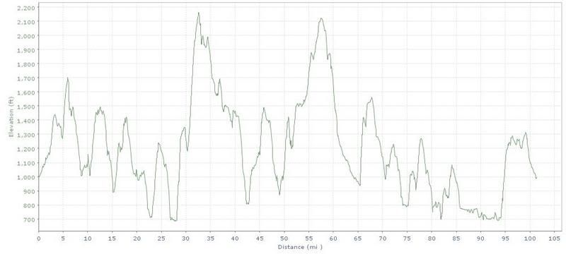
Highlander Elevation profile
Well, the day of The Highlander finally arrived yesterday. This is a century with over 11,000 feet of climbing and several climbs with a grade over 20%. (Checkout the About section on the Highlander website for a great description of the route.) The weather cooperated as it was a cool, overcast day with light winds. It was a bit misty in the morning but no rain developed and the roads were dry.
The ride was challenging, as expected. Although the route was changed slightly this year, it still included the three "killer" climbs up Bopple, Gannet, and Sliter. Two accomplishments this year: new all time maximum speed of 54 mph, and I did not have to walk up Sliter! I did the whole ride solo, which was good in that I was able to keep to my own pace.
Ride organization was excellent. The route was clearly marked and a map was provided. There was no cue sheet listing turns and distances but the map and road markings were great. No wrong turns at all. Rest stops were plentiful and well stocked, another improvement from last year's ride.
The Finger Lakes scenery was great. Overall, a very enjoyable ride.
I did not bring a camera but I did bring a GPS and I will post the route track here when I get a chance to download it at home.
Highlander GPS track on motionbased.com
This morning should have been an easy recovery ride but I felt like I had recoverd well from the century and did my usual Corning-Harris Hill loop. I will post the GPS track for that ride here as well.
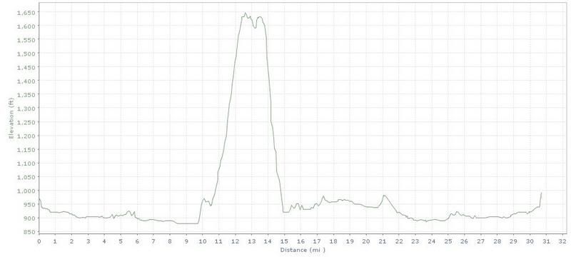
Corning-Harris Hill Elevation profile
Corning-Harris Hill GPS track
All in all, a great weekend of hill climbing for a change of pace from the usual LI landscape. I will update this post if I locate any photos at a later time.
No comments:
Post a Comment